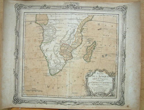
"Partie de l'Afrique audela de l'Equateur, Comprenant le Congo, la Cafrerie &c." 1766
Check my rate
| Main centres: | 1-3 business days |
| Regional areas: | 3-4 business days |
| Remote areas: | 3-5 business days |
Product information
"Partie de l'Afrique audela de l'Equateur, Comprenant le Congo, la Cafrerie &c." Brion de la Tour/Desnos dated 1766 Ref. MR14/1

Louis Brion de la Tour (1756-1823) was the Cartographer Royal to the King of France, his official title being "Ingenieur-Geographe du Roi". Despite a prolific cartographic career and several important atlases to his name, little is actually known of his life and career. What is known is that much of his work was produced in collaboration with Danish royal Cartographer Louis Charles Desnos (fl. 1750 - 1790). His most notable work is generally regarded to be his 1766 Atlas General.
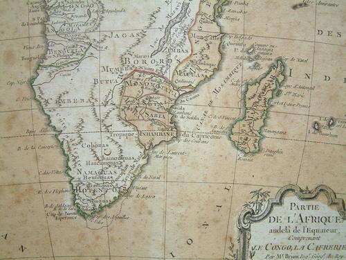
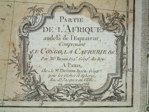
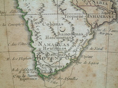
The cartographical content of this decorative map of southern Africa is moderately accurate. Hottentot tribes are mentioned and Fort Hollandois is shown as Cape Town. The western coast is labeled Cote Deserte with the kingdoms of Benguela, Angola, Congo and Benin delineated. On the east coast several kingdoms are shown including Monomotapa and Zanguebar. The title is enclosed in a decorative cartouche and map is enclosed in a rococo style border (printed from a separate copper plate), making this a very desirable map. Good impression and original color with a hint of toning along the centerfold, although the map does show a moderate amount of foxing.
The map itself measures 32cm x 29cm and, apart from the foxing (this can be attended to by a professional restorer) remains in very good condition with no tears or damage.
This is a genuine antique. Please remember the classification of an 'antique' is that it should be 100 years old, OR MORE. There are many articles being offered as 'antiques' when, clearly, they are not.
Post R35.00