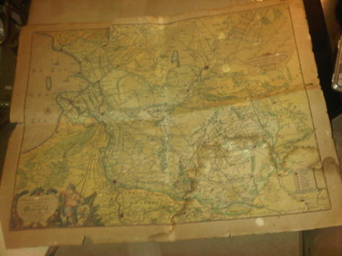
VERY OLD Dutch Map
Check my rate
| Main centres: | 1-3 business days |
| Regional areas: | 3-4 business days |
| Remote areas: | 3-5 business days |
Product information
This map is very old as it has the very old names of the land back then and it shows how rural the land is with very few communities and cultivated land. All the towns and villages are far apart and small. You can see the wind mills which Holland is known for and such detailing on the pictures shown and on the compass rose. The index and writing shown is very well done and with all the hand colouring and is very well all over. You can see the minutes and hours along the border of the map. This map is frail and has been through a very lot through its life to finally come all the way to South Africa. It shows there is some water marking on it and in vintage writing the number 74. is written in the 1 corner. A main name shown is : De Zuy Der Zee. Measurements : 62cm x 48cm.