Alexander Findlay 'Africa' Circa 1820 -1825 Ref. MA-1
Check my rate
| Main centres: | 1-3 business days |
| Regional areas: | 3-4 business days |
| Remote areas: | 3-5 business days |
Product information
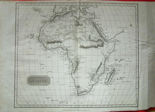
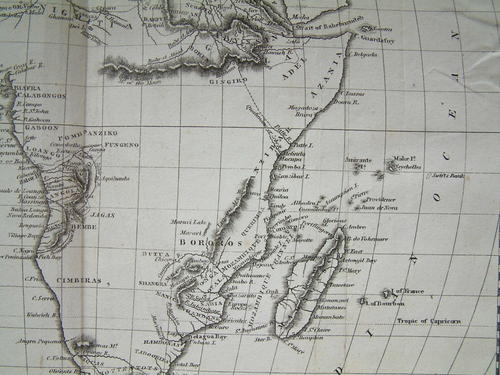
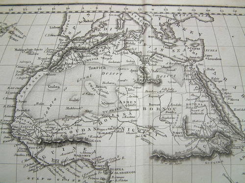
Alexander Findlay 'Africa' Circa 1820-1825 Ref. MA-1

A superb map of the Continent of Africa drawn by Alexander Findlay dated around 1820-1825 and published by Thomas Kelly, of No. 53, Pasternoster Row, London. Although there is no accurate date given for the above map, a very similar one drawn by Findlay appears in a gazetteer published in 1816 by Bartlett, Newman and Bartlett .
The differences between the two maps is the mountain range which crosses equatorial Africa is shown as a broken range in the above map as does the mountain range on the east coast of Mozambique, whereas in the map published by Bartlett, both mountain ranges are longer, the range in Equatorial Africa spanning the whole continent. I believe the map offered above is a later edition, as by 1850, in Modern Atlas by Findlay, the two ranges are both considerably smaller
Alex George Findlay (1812-1875) was born in London, son of Alexander Findlay, one of the original fellows of the Royal Geographical Society. His grandfather, a prominent ship owner, possibly inspired Alex in his career which was devoted to the compilation of geographical and hydrographical works. In 1884 he was elected a fellow of the Royal Geographical Society and did a great amount of research on meteorites. In 1858, Findlay took over the London print and geographical publisher, Laurie and Whittle, and turned it into the oldest active firm for the publication of nautical works and charts. 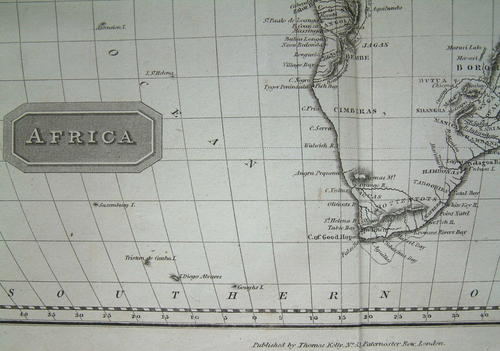
This is a genuine antique. Please remember the classification of an 'antique' is that it should be 100 years old, OR MORE. There are many articles being offered as 'antiques' when, clearly, they are not.
Price R550.00
Post R35.00
Terms: We offer a strict three-day approval period from the date the parcel reaches you. Refunds/credits are based on the cost of the article, NOT including delivery charges. Please advise us within this period whether you would like to return any article for a refund/credit. Although we pride ourselves in our packing, the buyer remains responsible for loss, non-arrival or damage to goods being sent to, or returned.